
From Dembi Dolo to Najo (see map 7).
|
Waypoint 068 | Lat. 8° 44′ 9.67″ N / Long. 35° 0′ 16.76″ E Mechara. Gashaw has told Getinet that scattered Anfillo live as far east as here. |
|
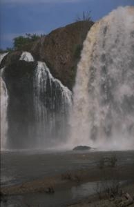
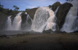
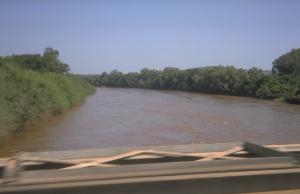
Waypoint 069 | Lat. 8° 46′ 37.8″ N / Long. 35° 2′ 7.57″ E Falls of the Qeeto, a tributary of the Baro. Slides. |
|
|
Move mouse over pictures to see a larger version with captions
|
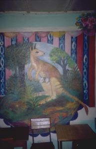
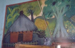
Waypoint 070 | Lat. 8° 51′ 43.7″ N / Long. 35° 4′ 19.33″ E Chanqa. Made photographs of murals in the coffee house (slides). A guest in the coffee house: Mbororo have passed eight to nine years ago seven kilometres north-west of here in Qaaqe (Kake on the map). They had cattle, camels, sheep, and goats. They sold cattle to the local people, but these did not succeed in breeding them. There are none left. They moved on, supposedly to Begi. Mao are found south-east of Begi, ten hours walk from Kake. |
|

|

|

|
|
Move mouse over pictures to see a larger version with captions
|
Waypoint 071 | Lat. 8° 59′ 16.15″ N / Long. 35° 19′ 40.52″ E Junction with road leading across the valley to Illubabor. Lalogile → Lagabirbir → Supe → Mattu, 96 km |
|
Waypoint 072 | Lat. 9° 9′ 51.88″ N / Long. 35° 28′ 25.72″ E Gulliso. Lunch. When asked about Mbororo ("Fellata"), the waiter does not know what we are talking about. |
|
Waypoint 074 | Lat. 9° 21′ 5.74″ N / Long. 35° 35′ 16.76″ E Dam (slides) |
Dam
Move mouse over picture for larger version
|
Waypoint 076 | Lat. 9° 24′ 25.1″ N / Long. 35° 37′ 2.08″ E We join the road from Gimbi to Najo. |
|
Waypoint 077 | Lat. 9° 30′ 34.11″ N / Long. 35° 29′ 47.93″ E Najo. Hoteela Waaq Woya ("God Leads") |